
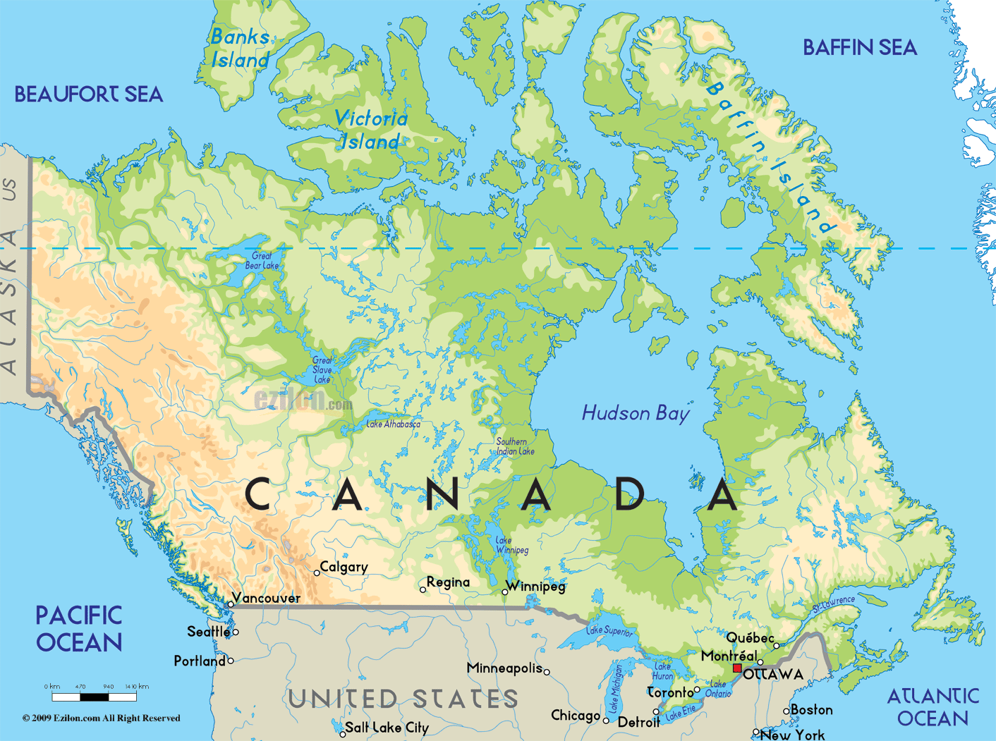
Canada is the most northerly country of the Americas and the second largest country in the world.
It borders the Atlantic Ocean to the east, the Pacific Ocean on the west, the Arctic Ocean to the north and the United States of America (USA) to the South. It spans a total area that covers almost ten million square kilometers (9,984,670 sq km). To put it into clear perspective, Canada could contain 18 countries the size of France, or 40 United Kingdoms. Canada has six time zones, as well as the longest coastline of any country.
Canada is a mosaic of regions, from the rugged mountains of the West to the farm communities of the prairies, from the industrial and political powerhouse of Ontario to the modern Francophone culture of Québec, and from the quaint fishing communities of the east coast to the great white North. The beauty and diversity of Canada are proud icons of what Canada has become.
Most of the country is made up of plains, with mountains in the west and prairies in the central areas. Approximately 90 per cent of the over 35 million people living in Canada are located within 160 km of the US border and about 75 percent of the total population lives in major cities or towns. There are more lakes and inland waters in Canada than in any other country. There are over two million lakes in Canada, which translates into 7.6 per cent (755,180 sq km) of the world's fresh water.
Canada is divided into 10 provinces and three territories. The northernmost part of Canada extends into the frigid Arctic Circle, while the southernmost parts stretch down to or below the US border. Canada and the United States share many geographic characteristics in common, such as the Rocky Mountains, four of the Great Lakes, the Appalachian Highlands, and various rivers.
Canada has a boreal climate. Winters are cold, with average daily temperatures ranging between -2.5°C and -10°C (though much colder temperatures are possible), while summers are relatively warm by comparison, with temperatures ranging between 16°C and 28°C in the southern regions. Canadian temperatures have climbed up to a scorching 35°C in the summer and descended to a glacial -40°C during winter.
British Columbia receives the most temperate climate in all of Canada. It rarely snows in the low-lying areas, and the Coastal Range and the Rocky Mountains prevent the Pacific air from traveling to the Prairies.
The Canadian Prairies traverse east from the Rocky Mountains all the way to the Great Lakes. Farming is a major industry in this part of the Country. Cold winters and muggy, hot, summers are common. Ample spring rainfalls and clement autumns make the Prairies one of the top grain growing areas of the world.
More than half of Canada's population lives near the Great Lakes or along the St. Lawrence River. Winter is very snowy and wind-chilled, while summers are humid and longer than anywhere else in Canada. There's enough rainfall to sustain the region's sizable farm industry.
This territory is quite inclement and has one of the most capricious weather systems anywhere in the country. In winter, temperatures can vary tempestuously as the Arctic's breath is replaced by maritime air from cursory storms. Snowfall is relatively strong, and fog is frequently present in spring and at the beginning of the summer season. July is the warmest month of the year.
North of the Prairies and the St. Lawrence is an expansive hyperborean forest. This area is snow-capped most of the year, and summer lingers for approximately two months. Above the tree-line lies the Arctic, temperatures rise above freezing only for a few weeks a year and the ground is permanently frozen.